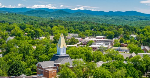
These Underrated National Forest Hikes in New Hampshire Rival Popular Trails at National Parks
These four hikes in New Hampshire’s White Mountain National Forest offer stunning views and thrilling challenges that rival some of the most famous trails in America’s national parks.
When you think of the most beautiful hikes in America, your mind probably goes straight to national parks like Yosemite, Acadia, Zion, or Glacier. But there’s a place in New Hampshire that rivals those iconic destinations with fewer crowds and equally stunning scenery: White Mountain National Forest. Located in the heart of New England, White Mountain National Forest features more than 750,000 acres of hardwood forests, lakes, and breathtaking mountains. It’s also a popular place to hike and backpack with over 1,200 miles of trails, as well as dozens of peaks exceeding 4,000 feet in elevation.
These five national forest parks in New Hampshire hold their own against some of the most famous national park trails in the U.S., from Half Dome in Yosemite to Angels Landing in Zion National Park.
1. Mount Chocorua

Rivals: Half Dome in Yosemite National Park
With 8.9 miles of pathway and 3,047 feet of elevation, the rugged Mount Chocorua Loop Trail on the southern edge of the White Mountain National Forest is a challenging route. It’s known for its sharp, rocky, and exposed summit that’s visible from miles away. From the top, hikers are rewarded with sweeping views of the Presidential Range, Ossipee Mountains, and Lake Winnipesaukee on a clear day.
Some hikers claim Mount Chocorua resembles a mini Half Dome—perhaps the most famous hike in Yosemite National Park. That’s because both mountains have distinctive silhouettes, granite-topped summits, exposed rock scrambles, and dramatic views from the top. But while both trails are challenging, Half Dome is more intense by nature. It stretches 16.5 miles round trip, gains over 5,300 feet of elevation, and requires hikers to ascend the final stretch using metal cables.
2. Franconia Ridge Loop

Rivals: Highline Trail in Glacier National Park
Some people consider Franconia Ridge Loop to be one of the top hikes in New England. Over the course of the 9.1-mile path, hikers gain about 3,900 feet of elevation, and they also summit three peaks: Little Haystack Mountain (4,760 feet), Mount Lincoln (5,089 feet), and Mount Lafayette (5,249 feet). While traversing the ridgeline, you’ll get sweeping views of the White Mountain National Forest, along with sections of forested terrain and alpine vegetation.
The Franconia Ridge Loop has been compared to national park hikes such as the Highline Trail in Glacier National Park, Montana. Both trails stretch along exposed ridgelines with panoramic views, which makes you feel like you’re elevated above the landscape. The full Highline Trail stretches 14.9 miles one-way, with significant elevation gain, though many hikers complete shorter versions. The trails each strike a balance between effort and alpine beauty, making them bucket-list hikes.
3. Arethusa Falls

Rivals: Bridalveil Fall Trail in Yosemite National Park
Arethusa Falls is located in the Crawford Notch State Park area of the White Mountain National Forest. It’s the tallest single-drop falls in New Hampshire— around 140 feet high. Many hikers enjoy the moderately difficult Arethusa Falls Trail. If you take the scenic variation via Bemis Brook Trail, the route is about 2.8 miles round trip with roughly 885 feet of elevation gain. Alternatively, you can hike the Arethusa Falls and Frankenstein Cliff Loop for more of a challenge; this hike is 5.3 miles with 1,650 feet of elevation gain.
In a way, Arethusa Falls is similar to Bridalveil Fall Trail in Yosemite National Park, California. You’ll come across a visually similar horsetail waterfall along the Bridalveil Fall Trail, though it’s much taller than Arethusa Falls at 620 feet. Both falls feature plunges over rock faces, have heavier flows in the spring, and are accessed via easy or moderate hikes. Bridalveil Fall Trail is 0.7 miles long with 82 feet of elevation gain.
4. Baldface Circle Trail

Rivals: Angels Landing in Zion National Park
If you’re an experienced hiker, you might want to tackle Baldface Circle Trail in the eastern White Mountains, along the border of New Hampshire and Maine. This loop stretches 9.4 miles and gains about 3,400 feet of elevation. Hikers will circle two peaks—South Baldface (3,547 feet) and North Baldface (3,606 feet), known for their sweeping views and open granite ledges.
Some hikers compare the Baldface Circle Trail to Angels Landing in Zion National Park, Utah. The similarities lie in the exposed ridgelines, hands-on rock scrambles, and summit panoramas. Baldface may not have anchored chains or sheer drop-offs like Angels Landing, but its granite slabs and open ridges offer a similarly exhilarating experience. For comparison, Angels Landing is around 4.3 miles with 1,800+ feet of elevation gain, and it requires a permit to access.
Subscribe to our newsletter
Get the latest updates and news
Thank you for subscribing!