Take An Unforgettable Scenic Drive Around The Highest Mountains In Arizona
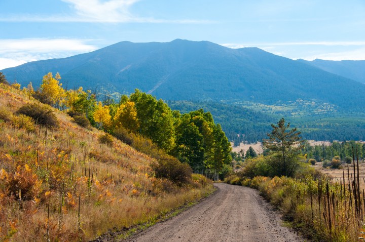
Why hike to the highest point in Arizona when you can enjoy the views from your car? Around the Peaks Loop takes you along the base of Humphreys Peak in Arizona and the surrounding mountains, making for a breathtaking drive no matter the season. Wondering something to the effect of “Can you drive up Humphrey’s Peak?” The literal answer is no, not technically – but the scenic drive around it is by far the next best thing. Pack some road trip snacks and hit the road!


Visit the Coconino National Forest website to learn more.
So can you drive up Humphreys Peak in Arizona? Well, kind of. It’s worth it – we promise! Have you ever driven down Around the Peaks Loop? If so, we’d love to hear your thoughts! Check out the best backroads in Arizona for a long scenic drive.
OnlyInYourState may earn compensation through affiliate links in this article. As an Amazon Associate, we earn from qualifying purchases.
More to Explore
Can You Drive Up Humphreys Peak
What are some other scenic drives in Arizona?
The drive along the base of Humphreys Peak is certainly one of the most beautiful drives in Arizona, but it is by no means the *only* scenic drive in the Grand Canyon State!
- One of our all-time favorite scenic drives in Arizona is U.S. Route 191, which spans some 500 miles through the state. Fun fact: In total, U.S. Route 191 covers 1,600 miles. It was designated in 1926, and is one of the longest three-digit routes in the country!) The Arizona portion of the acclaimed route begins in Cochise County at the intersection with Arizona State Route 80 (SR-80) and Historic U.S. Route 80 (Historic US-80) near Douglas.
- If you can't drive all 500 miles, the stretch between Springerville and Morenci is a must. This span is a National Scenic Byway, given the name "Coronado Trail" because it approximates the path taken by Francisco Vásquez de Coronado between 1540 and 1542.This treacherous mountain road is the primary point of access to the iconic Canyon de Chelly National Monument, traversing the Navajo Nation before entering Utah.
- If you're looking for a short and sweet scenic drive (you know, that *isn't* 500 miles long), try the Apache Trail. This beautiful road on State Route 88 curves around the Superstition Mountains for 41 miles from Apache Junction to Roosevelt Lake. If there’s any way to experience the Arizona desert, it’s through a drive like this where you can see mountains, canyons, and all the beauty that lives in it.


