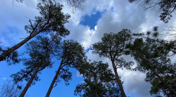
Old trees Discover 400-Year-Old Longleaf Pine Trees At Weymouth Woods Sandhills Nature Preserve In North Carolina By Carolyn Harmon
Airbnb The Harry Potter Airbnb In North Carolina Where You’ll Feel Like A Quidditch Champion By Carolyn Harmon
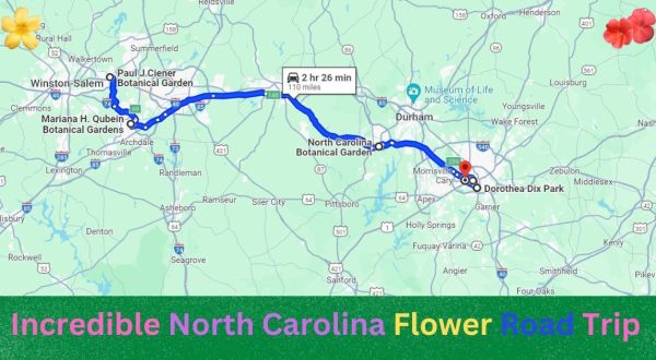
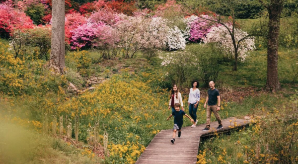
Road trip The Incredible Flower Road Trip Through North Carolina Is The Ultimate Spring Adventure By Carolyn Harmon
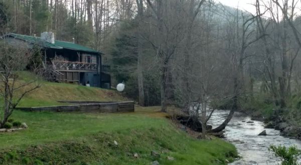
Airbnb 7 Waterfront Retreats In North Carolina That Are Perfect For Warm Weather Adventures By Carolyn Harmon
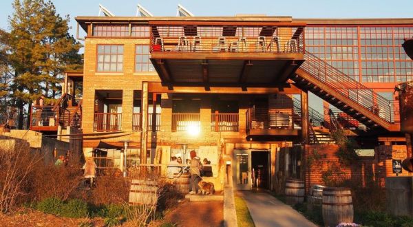
Speakeasy This Speakeasy Hidden Inside A Bar And Social House In North Carolina Is Perfect For A Date Night By Carolyn Harmon
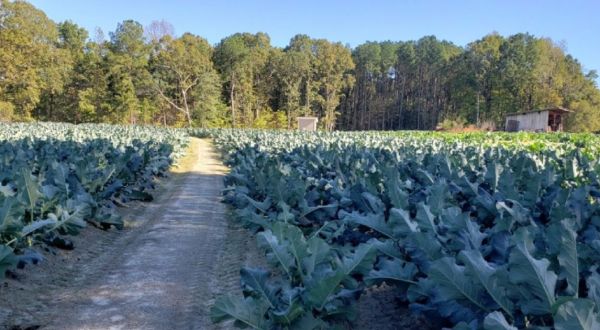
Collard greens The Little-Known Story Of Collards In North Carolina And How They Are Are Making A Big Comeback By Carolyn Harmon
North Carolina Explore 1920s Radio Manufacturing For Free At The Asheville Radio Museum In North Carolina By Carolyn Harmon
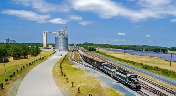
Trains This Is The Most North Carolina Sound You’ll Ever Hear, And We Can’t Stop Listening To It By Carolyn Harmon
Attractions Everyone In North Carolina Should Check Out These 15 Tourist Attractions, According To Locals By Carolyn Harmon
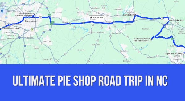
Bakery The Ultimate Pie Shop Road Trip In North Carolina Is As Charming As It Is Sweet By Carolyn Harmon
Restaurant Bombolo’s Sibling Chefs Are Serving Some Of The Freshest Pasta In North Carolina By Carolyn Harmon
Airbnb You Won’t Believe The Views You’ll Find At This Incredible Airbnb In North Carolina By Carolyn Harmon
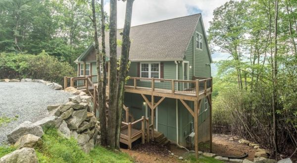
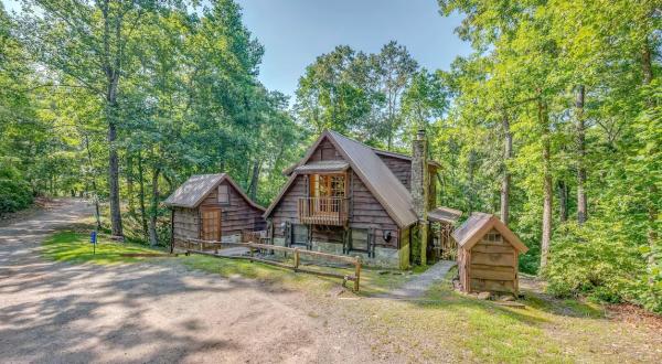
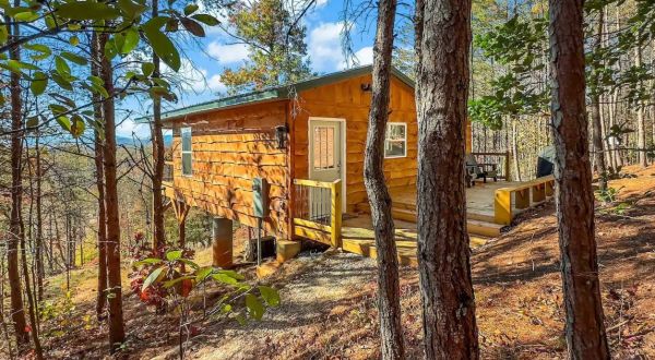
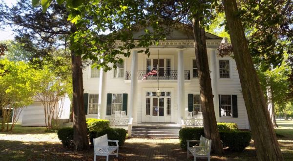
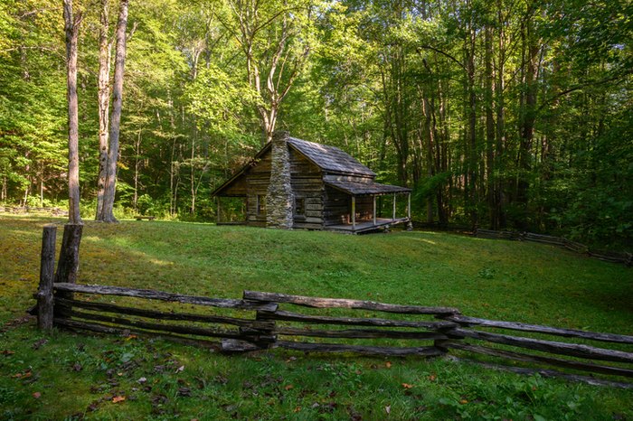
Best cabins in north carolina Here Are The 19 Absolute Best Places To Stay In North Carolina By Megan Todaro
Patio This Enchanting Garden Restaurant In North Carolina Will Transport You To Another World By Carolyn Harmon
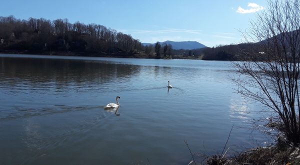
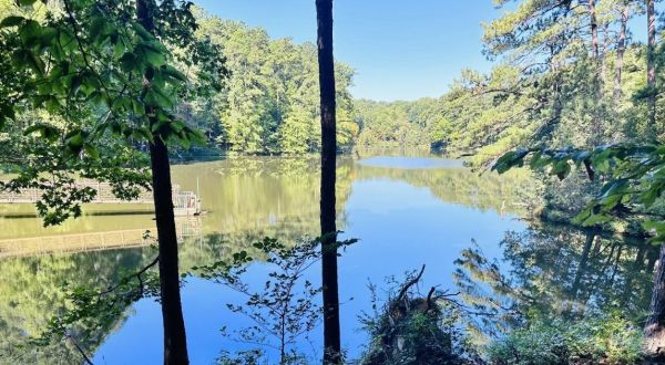
Lakeside trail I Love This Inspiring Lakeside Walking Trail In North Carolina That Is Home To An Ice Cream Shop, Swans, And A Chapel By Carolyn Harmon
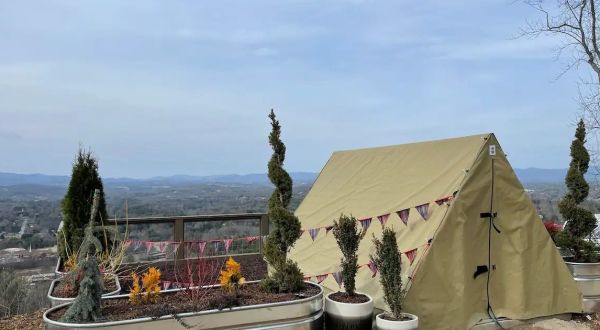
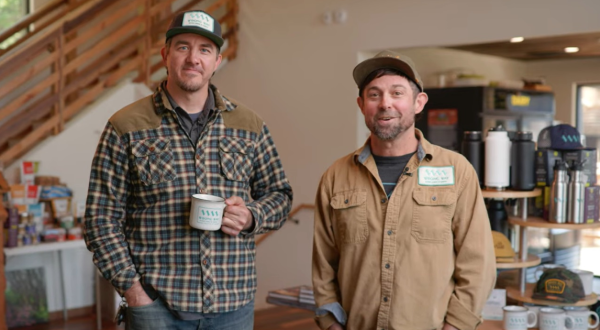
2024 Small Business Spotlight Owned And Operated By Longtime Best Friends, Wrong Way River Lodge & Cabins Is A Unique Urban Campground In Asheville, North Carolina By Beth Price-Williams
Fruitcake Southern Supreme Fruitcake & More In North Carolina Started In A Garage And Has Exploded In Growth Ever Since By Carolyn Harmon
Trail This Under Construction North Carolina Tourist Attraction Is Making A Comeback By Carolyn Harmon
Trail A Peaceful Escape Can Be Found Along The Sycamore Loop Trail In North Carolina By Carolyn Harmon
Rural restaurant Take A Drive To The Country To Dine At This Exceptional Rural Restaurant In North Carolina By Carolyn Harmon
The shag Learn The Rhythm and Steps of North Carolina’s Official Popular Dance, The Shag, With The Local Clubs By Carolyn Harmon
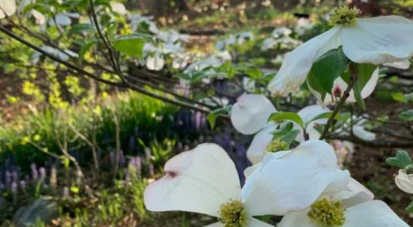
Spring You Won’t Want To Miss The Most Vivid Dogwood Bloom In North Carolina This Spring By Carolyn Harmon
Elizabeth city Celebrate One Of the State’s Delicious Crops This Spring At The North Carolina Potato Festival By Carolyn Harmon
Rutherfordton Explore This Secret Trail Around Alexander’s Ford Historic Site In North Carolina By Carolyn Harmon
History Crossing This 136-Year-Old Bridge In North Carolina Is Like Walking Through History By Carolyn Harmon
North Carolina The Remote And Rugged Trail In North Carolina That Will Lead You On A Grand Adventure By Carolyn Harmon
Rest area One Of The Country’s Impressive Rest Stops Is Hiding Right Here In North Carolina By Carolyn Harmon
North Carolina Pregnant Stingray In North Carolina Mountain Aquarium Despite Lack of Male Partner By Carolyn Harmon
Blue ridge mountains Study An Interesting Art And Enroll For Summer Workshops At Penland School Of Craft In North Carolina’s Blue Ridge Mountains By Carolyn Harmon
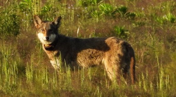
Endangered Did You Know North Carolina Is Home To The Only Wild Population Of Red Wolves In The World? By Carolyn Harmon
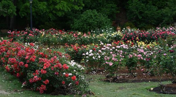
Garden The Little-Known Rose Garden In North Carolina That Will Melt Your Worries Away By Carolyn Harmon
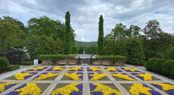
Garden The Paul J. Ciener Botanical Garden Tulips In North Carolina Will Be In Full Bloom Soon, And It’s An Extraordinary Sight To See By Carolyn Harmon
Attractions The Perfect North Carolina Getaways To Take If You Have Been Dreaming Of Europe By Carolyn Harmon
Airbnb The Perfect Spring Getaway Starts With One Of These 7 Picture-Perfect Airbnbs By Carolyn Harmon
North Carolina A Love Letter To My Favorite City In America: Asheville, North Carolina By Megan Shute
Trail This Easy 5.5-Mile Trail In North Carolina Is Covered In Wildflower Blooms In The Springtime By Carolyn Harmon
Unique experiences 9 Unique Experiences That Should Be On Everyone’s North Carolina Bucket List By Carolyn Harmon
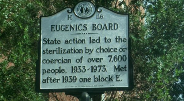
Eugenics program Few People Know The Real Story About North Carolina’s Eugenics Program By Carolyn Harmon
Wilmington Watch An Original Movie At The 3-Day UPTILT Film Fest In North Carolina That Showcases Films From Across The Globe By Carolyn Harmon
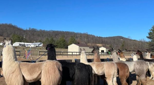
Day trip This Unique Ellaberry Llama Farm In North Carolina Is Perfect For A Day Trip Any Time Of Year By Carolyn Harmon
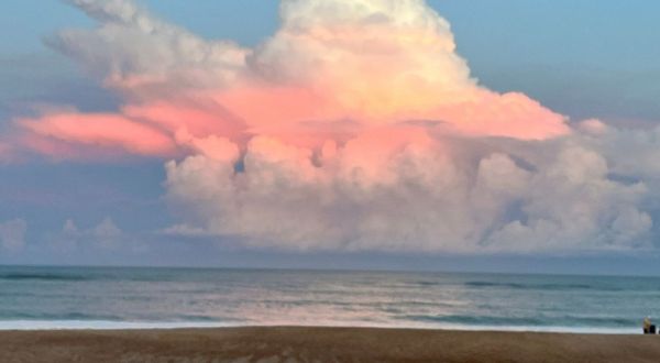
National park Cape Hatteras National Seashore In North Carolina Just Turned 71 Years Old And It’s The Perfect Spot For A Day Trip By Carolyn Harmon
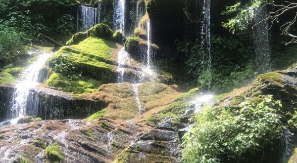
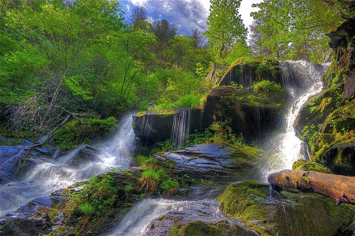
Waterfall Enjoy A Secluded Stroll On A Little-Known Path Along These Lovely North Carolina Waterfalls By Carolyn Harmon
Things to do Your Ultimate Guide To Spring Attractions And Activities In North Carolina By Jasmine Vieau
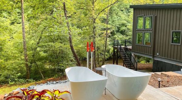
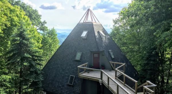
Mountains Enjoy The 180-View Of Hickory Nut Mountain Range At This Luxury Treehouse In North Carolina By Carolyn Harmon
Restaurant The Taco Fusion At 13 Tacos & Taps In North Carolina Is Insane And Outrageously Delicious By Carolyn Harmon
News anchor If North Carolina Had An Official News Anchor/Reporter, We Would Nominate Renee Chou By Carolyn Harmon
Outdoors 8 Winter Attractions For The Family In North Carolina That Don’t Involve Long Lines At The Mall By Carolyn Harmon
Durham North Carolina’s 1st Launching Slick Slide/Aerial Park Offers Tons Of Fun For All Ages By Carolyn Harmon
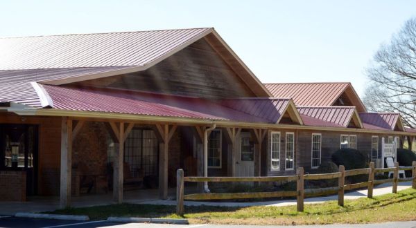
Historic sites There Are More Historic Places In This Rural North Carolina County Than We Can Possibly Count By Carolyn Harmon