These 15 Aerial Views In New Mexico Will Leave You Mesmerized
New Mexicans like to observe the world from a different perspective. After all, Spaceport America, the Earth’s first commercial spaceport, is located in the southern half of the state. We also provide lower tech ways to view the landscape, such as hot-air ballooning. The pattern of wind known as the "Albuquerque Box" makes our largest city ideal for the sport. So a surprising number of people take to the air above New Mexico. But what do they see? Blow your mind with these 15 aerial views of the state.
1. Unknown: Dry riverbeds snake through New Mexico.

2. Sierra Grande: This extinct shield volcano is part of the Raton-Clayton Volcanic Field, a relatively young volcanic field that encompasses 7500 square miles in total. A volcano field consists of many small volcanoes, rather than a single large one.

3. Near Blanco: Several canyons run through this section of northwestern New Mexico.

4. Shiprock: The elevation at the peak of this volcanic neck, which is located in the Four Corners Region, is 7177 feet. The Navajo name for the formation translates to "winged rock" and it is considered sacred.

5. Unknown: Snow outlines New Mexico's rocky landscape.

6. Near Las Vegas: Even from an aerial perspective, the distinctive red dirt, common in New Mexico, peeks through.

7. Unknown Mountains: New Mexico's rugged terrain is especially apparent from an aerial perspective.

8. Albuquerque: Many people fly over the city during the annual Balloon Fiesta, which takes place in October.

9. Bloomfield: The farmland in the northwestern part of the state resembles a giant board game from above!

10. Unknown: A river traverses a gorge in New Mexico.

11. Unknown: Some of New Mexico's scant surface water.

12. Foothills North Of The Zuni Reservation: Situated west of Albuquerque, the Zuni Reservation covers roughly 450,000 acres.

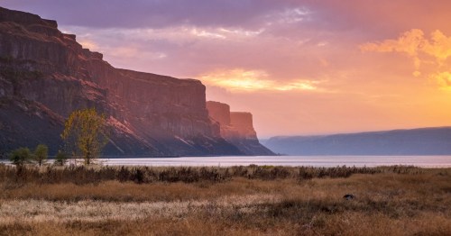
13. The Hogback Ridge: This ridge rises above New Mexico's San Juan Basin.

14. Unknown: This looks more like abstract art than a topographical view.

15. Kilbourne Hole: This National Natural Landmark is close to both the Texan and Mexican borders. It is a maar, or depression, resulting from a volcanic explosion. It is 1.7 miles in length and more than 1 mile wide.

What image inspires you to take to the skies? Let us known in the comments.
Subscribe to our newsletter
Get the latest updates and news
Thank you for subscribing!