Before Word Gets Out, Visit Massachusetts Newest Urban Walking Trail
The Boston City Walking Trail is a 27-mile urban hike connecting various parks, paths, and historic sites in Boston.
Boston is known for many things, including its history, culture, and educational institutions. But what also makes this place extra special are all the beautiful parks, walking paths, and gorgeous outdoor spaces that lie within the city and its surrounding communities. If you are looking for a fun way to tour the city on foot, you should definitely check out one of Massachusetts’ newest walking trails.
The Boston City Walking Trail is a 27-mile urban hike that connects several existing paths, parks, and gardens into a single route. It runs from the Neponset River Reservation all the way to the Bunker Hill Monument.

Along the path, you will walk through 17 neighborhoods, historic areas, and various communities. The entire point-to-point route takes a little over nine hours to complete and is considered moderately challenging. If you are like me and like to stop often to take in the sights, it may take longer to walk. Luckily, the hike is mapped to be broken down into four smaller sections that you can complete at your leisure.
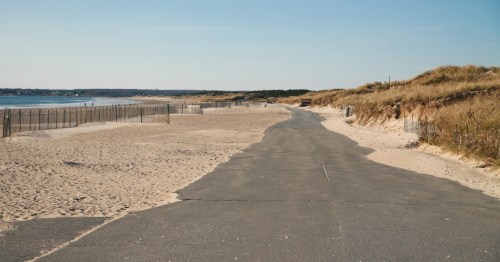
The first section of the hike starts south of Boston at the Harvest River Bridge in Mattapan.

You will see some beautiful natural scenery as you walk over the Neponset River through the Sherrin Woods and Stony Brook Reservation. This 8.3-mile stretch, which ends at Adams Park in Roslindale, is considered a relatively easy section of the hike.
Section two runs 5.7 miles and is considered to be a little bit more challenging but equally as beautiful as section one.

As you leave Adams Park, you will pass through Arnold Arboretum, which is a wonderful place to stop and see some gorgeous flowers and trees.
The trail continues on through Franklin Park (be sure to stop to see the abandoned bear cages) and ends at the Jamaica Pond boathouse.

If the weather is warm, spend some time exploring the pond. You can rent a sailboat, paddleboard, or kayak and relax on the water.

This funky bench is also worth checking out! It was originally placed here as a prank, but has since become a permanent fixture and somewhat of a tourist attraction.
The next section of the Boston City Walking Trail is an easy 6.1-mile route from Jamaica Pond to the Charles River Esplanade in Boston’s Back Bay.

The trail takes you to the top of Mission Hill and through Frederick Law Olmsted’s beautiful Emerald Necklace.
You are now in the homestretch! The final part of the trail is an easy urban walk that spans 7.3 miles.

You will really get a feel for the city as you explore the Boston Common, Chinatown, and the city’s North End. The trail ends at the historic Bunker Hill Monument in Charlestown. Still have energy to spare? It’s only 294 steps to the top!
Have you explored the Boston City Walking Trail? Did you hike the whole 27 miles at once or did you split your walk up into sections? For more information about this trail including turn-by-turn directions, please visit the Boston Walking City Trail's official website. If you decide to hike the whole trail over a few days, consider stopping at this newly renovated apartment near the halfway mark.
Subscribe to our newsletter
Get the latest updates and news
Thank you for subscribing!