18 Wisconsin Hikes Along the Ice Age Trail That Are Picture Perfect in the Winter
Start buying more frames because these 18 Wisconsin Ice Age Trail hikes will yield pictures you won't be able to wait to hang on the wall.
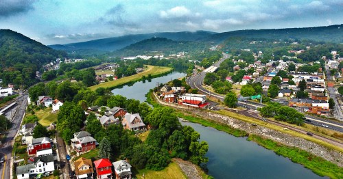
Did you know that the most recent North American advance of the North American ice sheet is known as the Wisconsin Episode? So much of our terrain was determined by the glaciers that moved through our land and made changes along the way. The 1,100-mile Ice Age National Scenic Trail is one of just a handful of nationally recognized trails in the country, and it gives us the incredible opportunity to see and enjoy protected areas of our state that have been thousands of years in the making - not to mention, it offers some of the best places for winter hiking in Wisconsin.

1. Gibraltar Rock Segment - Columbia County
The Gibraltar Rock Segment is a 4.6-mile stretch that goes from the Merrimac ferry across the Wisconsin River to the summit of Rocks of Gibraltar State Natural Area in Lodi. Worth it for the view no matter the time of year, the lack of leaves can leave you with better visibility and the ability to see the striations of the butte formation.
2. Spingfield Hill Segment - Dane County
Located just outside of Madison near Sauk City, this segment is just under two miles. Winter in Wisconsin allows great visibility on the slightly higher terrain and gives views in all directions.
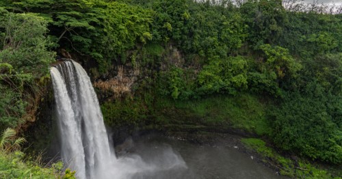
3. Grandfather Falls Segment - Lincoln County
This hike is about four miles along the banks of the Wisconsin River in the steps of Native Americans and fur traders who used it centuries before. The falls are a bit more like rapids, but still make for gorgeous views - and pictures!
4. St. Croix Falls Segment - Polk County

Basalt outcroppings and rock steps line this 2.4-mile hike. Located in Interstate State Park, Wisconsin's oldest state park, this is one of the best winter hikes in Wisconsin.
5. Eagle Segment - Waukesha County
These next three segments all run into each other in the Southern Kettle Moraine. Hike 5.6 miles through prairies and wetlands and see a portion of the Niagara Escarpment called Brady’s Rocks that weaves through 8-foot-tall dolomite outcroppings.
6. Blue Spring Lake Segment - Jefferson County
Home of Bald Bluff, which offers great views, as well as a massive granite erratic known as the Stone Elephant.
7. Blackhawk Segment - Walworth County

This stretch is 8 linear miles and starts out more open as it skirts a lake before heading into a more forested area and a series of small kettles.
8. Jerry Lake Segment - Taylor County
This segment is in the thick of the Chequamegon-Nicolet National Forest and covers 15 miles of the Chippewa Moraine. There is a mile-long esker that was left by retreating glaciers. The path also crosses both forks of the Yellow River.
9. Plover River Segment- Marathon County
This segment passes through the Plover River Fishery Area. There are more than 1,000 feet of volunteer-built boardwalk to help you traverse the wetlands.
10. Dells of the Eau Claire Segment - Marathon County

There's a break in the trail after the Plover River segment, but it picks back up with the Dells of the Eau Claire. This segment follows the banks of the Eau Claire River and if it's not frozen, you'll see eddys, whirlpools, and small waterfalls.
11. Lodi Marsh Segment - Columbia County
Sometimes overlooked due to its proximity to Gibraltar and Devil's Lake, you'll get a completely different terrain in the marsh. There are multiple (directional) segments of the trail in the Lodi Marsh.
12. Parnell Segment - Sheboygan County
Located in the Northern Kettle Moraine, this segment is home to the world-famous Parnell Esker and a great observation tower.
13. Indian Lake Segment - Dane County
Located in the nearly 500-acre Indian Lake State Park, this segment is great because it can be a simple 2.8 miles, but can be extended to 5 miles. The area is popular for snowshoeing and the park has a warming house.
14. West Bend Segment - Washington County
Located in the Glacial Blue Hills Recreation Area, this is one of the more strenuous segments. A series of hills and valleys show the changed glacial landscape.
15. Harrison Hills Segment - Lincoln County
This segment has the highest point along the Ice Age Trail, Lookout Mountain. This segment is more than 14 miles long, but there is a tower open to the public to give you a bird's eye view of the surroundings. Well worth it.
16. Straight Lake Segment - Polk County
A rather wild and uninterrupted park, this Ice Age Trail is actually the only path through the park. A perfect place to get out in the wild and explore.
17. Sturgeon Bay Segment - Door County

The eastern terminus of the Ice Age Trail, this segment hugs Sturgeon Bay and offers stunning views of the coast and Lake Michigan.
18. John Muir Park Segment - Marquette County
Not only does this segment put you literally in Muir's footsteps on land he once owned, but it is a quick and easy jaunt. Just 1.7 miles in its entirety, it circles the 30-acre spring-fed Ennis Lake.
Have you hit the Ice Age Trail in the winter? Share with us your favorite hikes! Don't forget to track all your hikes on AllTrails+ and share your pictures with us, too! Looking for more winter adventure? Check out these 12 Spots in Wisconsin you must explore this winter
Subscribe to our newsletter
Get the latest updates and news
Thank you for subscribing!