The 8.4-Mile Caribou Rock Trail To Rose Falls Might Just Be The Most Enchanting Hike In Minnesota
The Caribou Rock Trail in Minnesota offers a challenging 8.4-mile hike with rewarding views and a beautiful waterfall at Rose Falls.
Some folks will tell you that the reward is in the journey, and the journey along the Caribou Rock Trail is certainly rewarding. But it's also challenging. And when the journey is a little arduous, I think it's nice to have a payoff at the end - something to look forward to. Fortunately this trail doesn't disappoint in that regard either. This is a Minnesota waterfall hike that rewards 4.2 miles of rugged trail with a gorgeous cascade that you're likely to have to yourself. Here's what you can expect.
The Caribou Rock Hiking Trail to Rose Falls is 8.4 miles out-and-back (4.2 to the falls and 4.2 back to the trailhead).

You'll find the trailhead on Hungry Jack Road at the edge of the Boundary Waters Canoe Area Wilderness.
It's just under two miles off the Gunflint Trail, near Hungry Jack Lake. If you see the entrance to Hungry Jack Lodge, you've gone too far.

At the trailhead, you'll self-issue a day-use permit to enter the Boundary Waters. If you plan to hike in and camp, you'll have to obtain an overnight permit from a Superior National Forest ranger station (there's one in Grand Marais) or on Recreation.gov. If you're planning an overnight hike in the summer, be sure to get your permits well in advance, as they do run out.
The entire trail is in the Boundary Waters, so it is generally well-maintained, but you may encounter downed trees that haven't been cleared or spots that need maintenance.

Trails in wilderness areas like the BWCAW are maintained by crews who must walk in on foot and use hand tools to comply with federal wilderness area regulations, so it can sometimes take a while for a trail to be cleared - but it eventually gets done.
Some of the Caribou Rock Trail, however, is naturally rugged. Expect to scramble over rocks and roots in places along the footpath.

And you can look forward to about 1,475 feet of elevation gain over the 8.4 total miles. It's definitely a leg day.

I recommend trekking poles - they sure help me!
With all this challenging terrain, though, comes great reward.

You'll enjoy sweeping vistas over some of the most remote boreal forest in the Lower 48.

Views of Moss, Duncan, and West Bearskin lakes are frequent on the trail.

These pristine lakes are gorgeous from the trail's lofty overlooks.

And from their shorelines, which you can access via several portage trails.

Ultimately, the Caribou Rock Trail intersects with the Border Route Trail, and here, on the stream that flows between Rose and Duncan lakes, you'll receive your reward: Rose Falls.

Sit, relax, and enjoy the falls for a while.You can get an idea of what you have to look forward to in this YouTube video from Base Camp North:
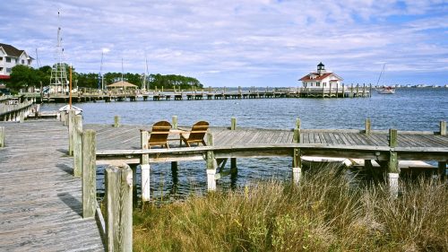
And your reward for hiking back out? Well, for one, you get to be done hiking for the day. Better still, you're less than a mile from a hearty burger or sandwich (try the reuben!) and beer at nearby Hungry Jack Lodge. It's just a little farther down Hungry Jack Road from the trailhead.
Please keep in mind that cell service ranges from spotty (at best) to nonexistent (most typical) in this part of the state. So, if you plan to navigate with your phone, be sure to download maps ahead of time with a tool like AllTrails+ - you can also use it to print off paper maps to bring along as back up, which you should always do when hiking.
Have you hiked the Caribou Rock Trail to Rose Falls? Tell us about your experience, or share any tips or tricks you may have in the comments!
Subscribe to our newsletter
Get the latest updates and news
Thank you for subscribing!