I Hiked This Historic Hiking Trail in Michigan, Here’s What I Learned
This Michigan state park's history is intertwined with the mining industry. Learning about it was a fascinating journey.
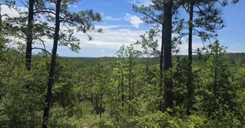
I would argue that Michigan's Porcupine Mountains Wilderness State Park is not only one of the best state parks in the Great Lakes State, but it's also one of the premier state parks in the entire country. At more than 60,000 acres, it's one of the largest state parks in the U.S., and much of its landscape is covered in pristine, old-growth hardwood forest. It's one of the largest remaining examples of such forest west of the Appalachians. Combine this with gorgeous Lake Superior shoreline, numerous waterfalls, and stunning Lake of the Clouds, and the Porkies are hard to top. Even beyond the park's natural beauty and recreational opportunities, which include downhill and cross-country skiing runs, as well as 90 miles of hiking trails, the human history in the area is fascinating. One short hike in the park delves particularly deep into this aspect of the landscape: the Union Mine Interpretive Trail.

You'll find the trailhead for the Union Mine Trail a mile-and-a-half south of the park visitor center, along South Boundary Road. The trail begins and ends at a small parking lot just off the road (look for the big shovel stuck in the ground). Named for one of two mid-nineteenth-century mining operations that took place in this area, which was, in turn, the namesake of the Union River that flows through the valley, the trail is a relatively easy, 1.1-mile loop with little in the way of elevation gain (a modest 114 feet over the length of the trail). You'll encounter protruding roots or rocks in the trail, as well as a few stairs, in a couple of spots, but it's all quite manageable for the average hiker.

The trail largely tracks the course of the narrow Union River and its dramatic forested valley. The hike is punctuated with dramatic rock outcroppings, gurgling streams, and small waterfalls along the way.

The park does a particularly good job with signage along the trail, detailing the history of the Union Mine, which was hand-excavated in the 1840s, and illustrating the day-to-day lives of the workers with passages from a miner's journal.
One of the entrances to the mine's two shafts is still open and clearly visible. It's surrounded by a chain link fence for hikers' safety, but you can still catch a glimpse of the narrow, vertical shaft and imagine what it was like to work in such conditions with nothing but candles for light.

Even if the park's mining past isn't something that interests you, the trail still makes for an easy-but-beautiful hike that highlights in short fashion the incredible natural beauty of the Porkies. Just ignore the interpretive signs and enjoy the forest, river, and waterfalls as you hike.

For me, though, it was fascinating to learn how much mining had to do with the history of this incredibly beautiful wilderness. Just a few minutes outside the park's boundaries, you'd find a different story, places where mining—an economically critical activity in this part of Michigan—has been less kind to the landscape. What I came away with, though, was just how intertwined these two economic drivers, extractive industries and nature tourism, have become on the Upper Peninsula, especially when viewed through the lens of history on the Union Mine Interpretive Trail.
Have you hiked the Union Mine Interpretive Trail in Michigan? We'd love to hear about other trails in the Great Lakes State that have stories to tell.
Subscribe to our newsletter
Get the latest updates and news
Thank you for subscribing!