
Few People Know About This Bloody Civil War Battle That Helped Set The Boundary Between West Virginia and Virginia
×

Cristy
Author
The year is 1861. It’s the middle of winter, and Confederate and Union troops are camped throughout the Virginia highlands. It’s been a particularly cold winter, many soldiers are sick, and morale is low.
But the American Civil War has only just begun.

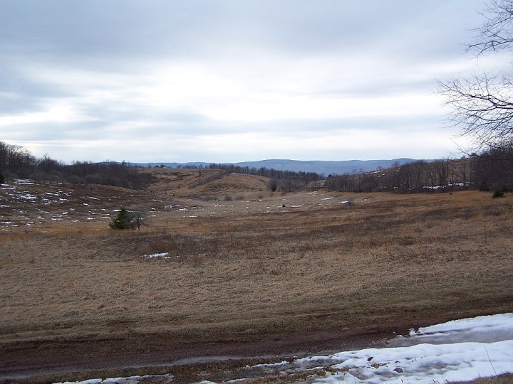
You would never know by looking at it now, though: it's a peaceful, lush high mountain meadow.

Here's what a portion of the Staunton and Parkersburg Turnpike looks like today.
Advertisement
Related Stories

You'll Never Look At Mini Donuts The Same Way After Trying Drifter Doughnuts In West Virginia

Escape To The Countryside When You Stay At This Rural Airbnb In West Virginia

The Incredible Flower Road Trip Through West Virginia Is The Ultimate Spring Adventure
The Confederate leader Edward Johnson earned his nickname from this battle: "Allegheny" Johnson. The Union army was led by Robert H. Milroy.
Advertisement


Incidentally, Allegheny Mountain forms part of the Eastern Continental Divide, so a portion of the state border follows that line.
Did you know the history of the Battle of Allegheny Mountain (also known as the Battle of Camp Allegheny)? Many other significant Civil War battles were fought in our state, including the Battle Of Rich Mountain or the Battle of Droop Mountain.
OnlyInYourState may earn compensation through affiliate links in this article. As an Amazon Associate, we earn from qualifying purchases.
Featured Addresses
Allegheny Mtn, Huttonsville, WV 26273, USA