
A Journey Through This Pennsylvania Ghost Town Is One You Won't Forget

Kathleen Butler
Author
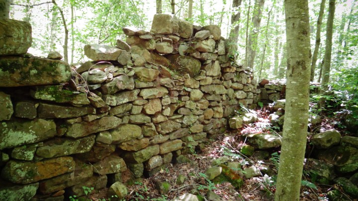
Nestled in the woods between Route 209 and Lehigh River/Lehigh Valley Gorge near Jim Thorpe Pennsylvania (formally Mauch Chunk Pennsylvania, “The Switzerland of America”), was once a town that consisted of a few houses that stood on an acre or two of land. Foundations still exist of where homes once stood.
Nature is doing what it does best, reclaiming the grounds where man has once made his home. A few structures are hard to make out as trees, bushes, and weeds grow in them, but other structures must have been homes.
Established in the late 1700s, Lausanne had the potential of becoming a booming rail and coal town. But floods plagued the area and when it went up for sale, the asking price was too much and the rail and coal industry was starting to thrive more in surrounding areas. This was the ultimate demise of this town.
The town name of Lausanne is no longer, however, there is now the Township of Lausanne.
The Adventure:


Related Stories
We Wandered Off-The-Beaten Path And Discovered This Adorable Small-Town Diner In Pennsylvania
The Seasonal Farmers’ Market In Pennsylvania That We’re Absolutely Obsessed With
Our Favorite Pittsburgh Diner Dishes Up Delicious Comfort Food At Some Darn Good Prices


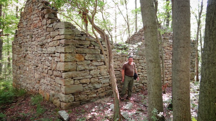


It’s hard to believe that a town like this is forgotten right here in Pennsylvania, crumbling without too many people knowing it existence.
How To Get Here:
Park along route 209 at the coordinates: N 40° 52.331 W 075° 45.628
There are a few spots to park along this highway, but this seems to be the best spot. There is only enough room for about 3 cars.
There is a lightly worn trail at the end of the parking area. Go down that trail and you’ll be led to an area that is mostly populated by ferns and other brush. You can still walk through it without bushwhacking.
It is a downhill hike to the railroad tracks. Once you have arrived at the railroad tracks, you’ll need to go left. Always be sure to mark the spot you came out of so you can find it on your way back.
It’s about a ½ mile walk to the worn trail entrance you’ll be looking for that’ll be on the right. You’ll need to pass a small building that will be on the left, and it’s just down a bit from there. Don’t get confused with the worn vehicle trails that you will see.
Once you have found the worn hiking trail, go down and follow that trail that hooks left. You’ll be led to the bridge that will need to cross over a stream. Once you have crossed, keep going. You’ll go over another smaller stream, keep going until the trail gets wider and splits at the base of the mountain. Go left and it will bring you to most of the ruins. To get to the two more complete ruins, keep following the trail that continues over the stream. Here are two more ruins that seemed to have been the bridge. Cross that and follow that trail. The ruins are not too far off the trail.
OnlyInYourState may earn compensation through affiliate links in this article. As an Amazon Associate, we earn from qualifying purchases.