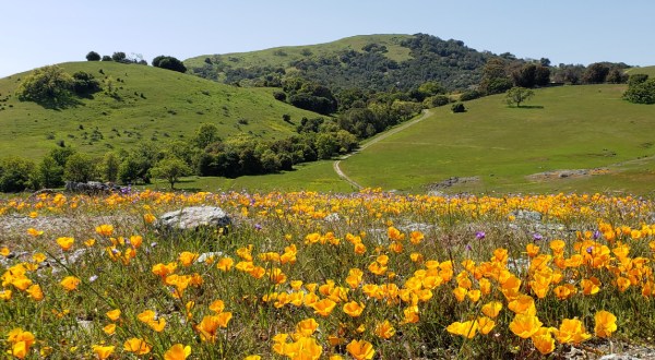
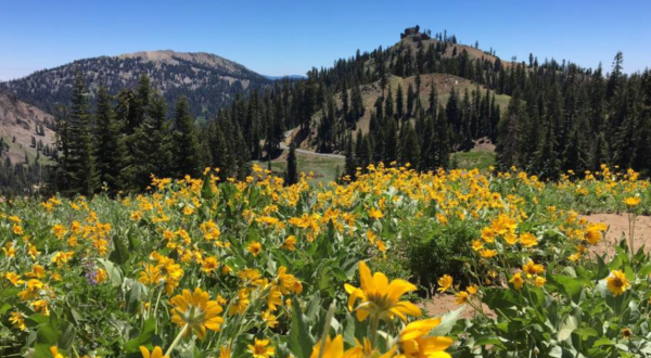
Hiking trails This Easy 3.4-Mile Trail In Northern California Is Covered In Wildflower Blooms In The Springtime By Kate Freeman
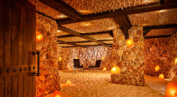
Salt Cave The Little-Known Salt Cave In Northern California That Will Melt Your Worries Away By Megan Todaro
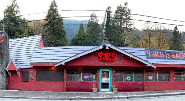
Largest The Largest Sticky Buns In Northern California Require Two Hands At Yaks On The 5 By Megan Todaro
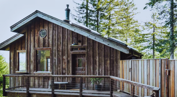
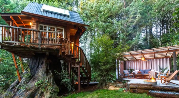
Treehouse This Remote Treehouse In Northern California Is The Best Place To Spend A Long Weekend By Megan Todaro
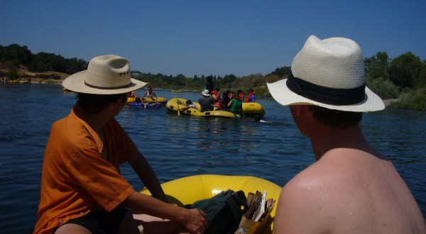
American River 5 Lazy River Summer Tubing Trips In Northern California To Start Planning Now By Kate Freeman
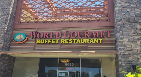
Buffets Your Stomach Will Love You For Trying These 6 Epic Buffets In Northern California By Kate Freeman
Sacramento restaurants The Unusual Ingredient On This Northern California Pizza Will Convert Any Skeptics By Kate Freeman
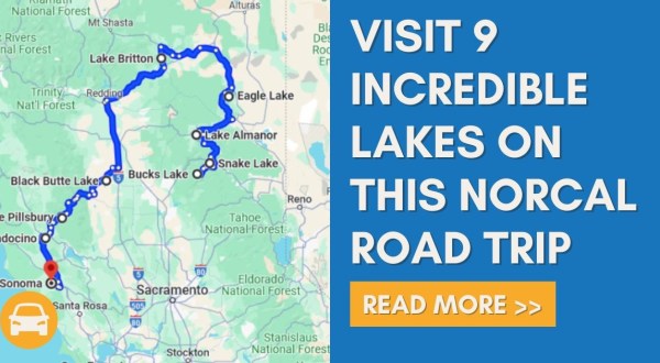
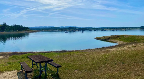
Norcal lakes The Incredible Road Trip Through Northern California That Leads You To 9 Stunning Lakes By Kate Freeman
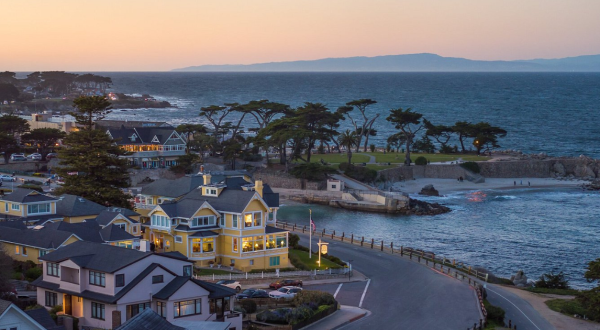
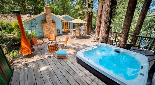
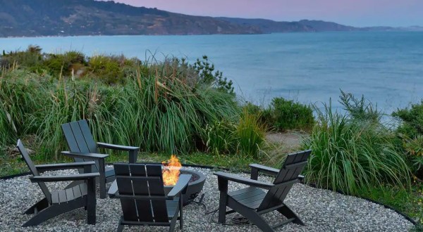
Airbnb You Won’t Believe The Views You’ll Find At This Incredible Airbnb In Northern California By Kate Freeman
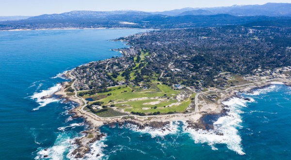
Road trip Discover 7 Of Northern California’s Most Iconic Views On This Epic 10-Hour Road Trip By Kate Freeman
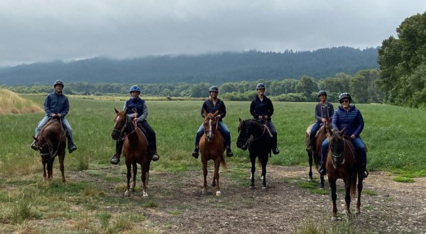
Horseback It’s An Epic Outdoor Adventure Riding Horseback In Humboldt County In Northern California By Kate Freeman
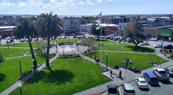
Small cities This Unique Little City In Northern California Is Perfect For A Day Trip Any Time Of Year By Kate Freeman
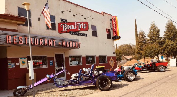
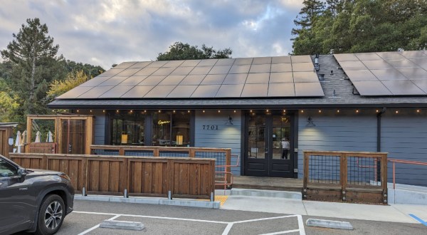
Norcal restaurants You’d Never Expect To Find Such A Happening Restaurant On This Rural Two-Lane Road In Northern California By Kate Freeman
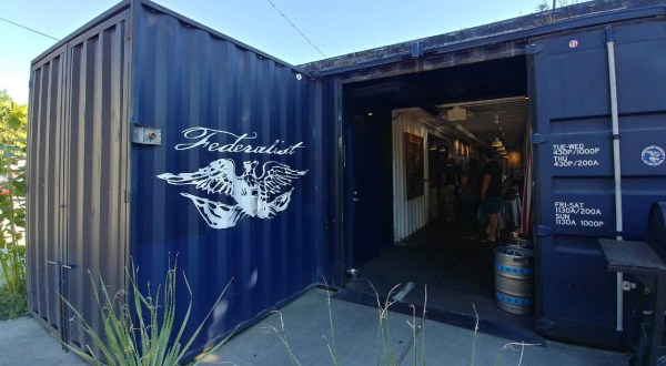
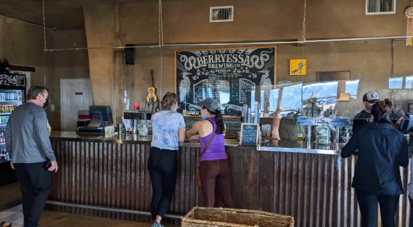
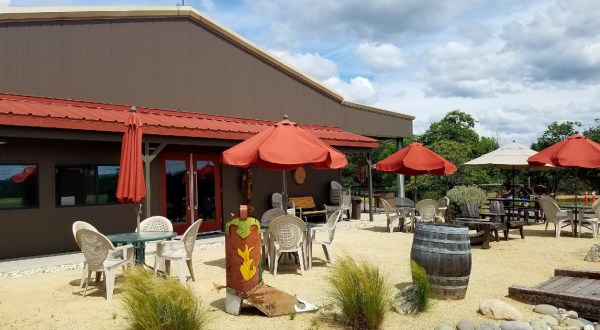
Breweries Take A Drive To The Country To Experience This Rural Brewery In Northern California By Kate Freeman
Rentals This Northern California Airbnb Was Built On A Massive Tree Stump And Has An Incredible Outdoor Living Space By Kate Freeman
Sonoma county The Surprising Story Of How One Of Northern California’s Most Famous Rivers Got Its Name By Kate Freeman
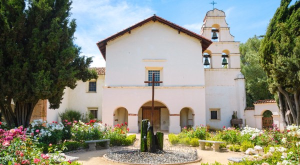
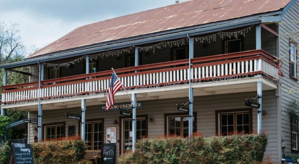
Bed and breakfast What Was Once A Saloon And Boarding House, Volcano Union Inn Is A Fascinating Place To Stay In Northern California By Kate Freeman
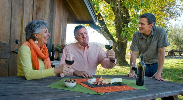
Wine tasting Sip And Sample Your Way Through Placer County on This Northern California Wine Trail By Kate Freeman
Things to do Your Ultimate Guide To Spring Attractions And Activities In Northern California By Jasmine Vieau
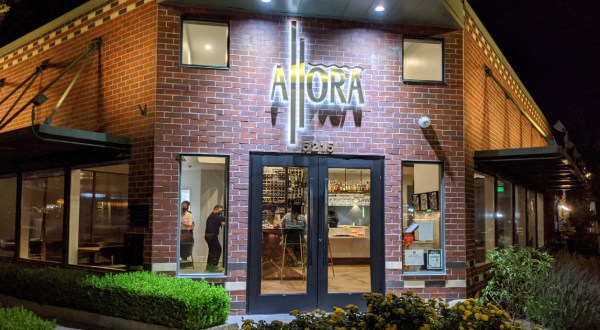
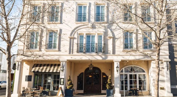
Fine dining Allora, A Michelin Restaurant, Serves One Of The Best Multi-Course Meals In Northern California By Kate Freeman
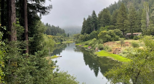
Hiking trails Enjoy A Secluded Stroll On A Little-Known Path Along This Iconic Northern California River By Kate Freeman
Wear your roots This NorCal City Boasts A Massive University Infusing Unbeatable College-Town Vibes By Kate Freeman
Food festivals Get Your Chocolate Fix At Northern California’s Sweetest Spring Festival By Kate Freeman
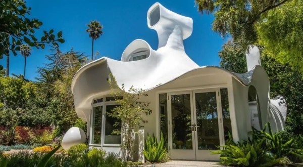
Unique airbnbs The Incredible Spaceship Airbnb You’d Never Expect To Find In Northern California By Kate Freeman
Humboldt county The Unique City In Northern California That Is So Much More Than Your Average College Town By Kate Freeman
Airbnb The Cozy Cabin In Northern California That’s Ideal For Winter Snuggles And Relaxation By Kate Freeman
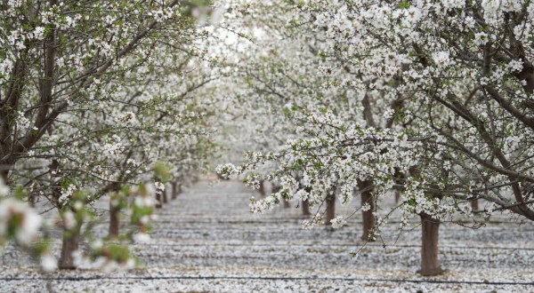
Winter festivals Started In 1962, This NorCal Almond Festival Celebrates The Abundance Of The Season By Kate Freeman
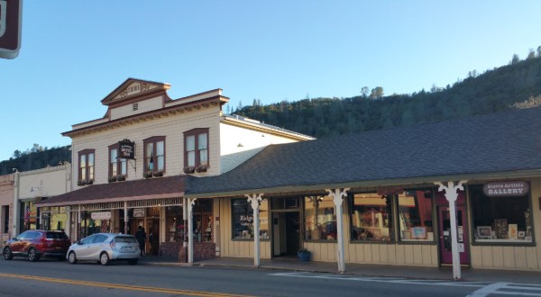
Gold Rush towns Spend A Weekend In This Under-The-Radar Northern California Town Chock Full Of History By Kate Freeman
Weekend getaway Northern California’s Northernmost Beach Town Is Perfect For A Weekend Getaway By Kate Freeman
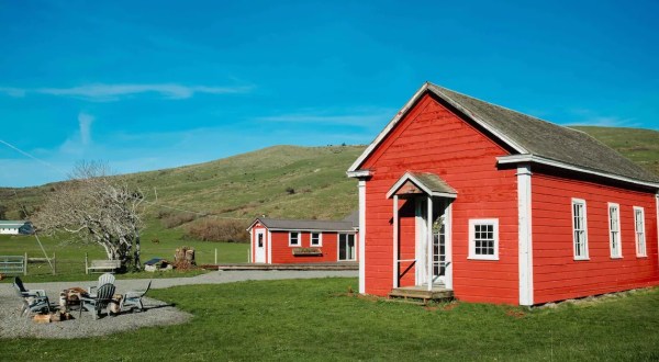
California coast Stay In A Former Schoolhouse Overlooking A Working Cattle Ranch In Northern California By Kate Freeman
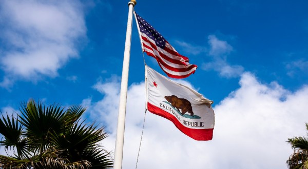
Fun facts 8 Unique Trivia Facts About Northern California You Might Not Have Heard Before By Kate Freeman
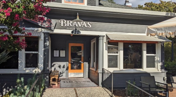
Tapas We’ll Choose Snacks And Apps Over Dinner Any Day At This Northern California Restaurant By Kate Freeman
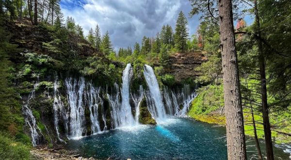
Daytrips Castle Crags State Park In Northern California Just Turned 90 Years Old And It’s The Perfect Spot For A Day Trip By Kate Freeman
Things to do Everyone In Northern California Should Check Out These 13 Tourist Attractions, According To Locals By Kate Freeman
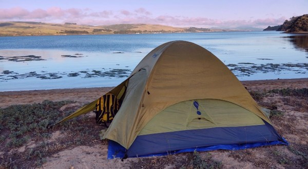
Winter camping One Of The Best Campgrounds In Northern California Is Open For Adventure Year-Round By Kate Freeman
Gas station restaurants Don’t Pass By This Unassuming Deli Housed In A Northern California Gas Station Without Stopping By Kate Freeman
Wine country The Perfect Northern California Getaway To Take If You Have Been Dreaming Of Europe By Kate Freeman
Hidden gems The Cozy Restaurant In Northern California That’s Perfect For An Intimate Dinner By Kate Freeman
Hidden gems The Small-Town Restaurant That Is Worth A Visit From Anywhere In Northern California By Kate Freeman
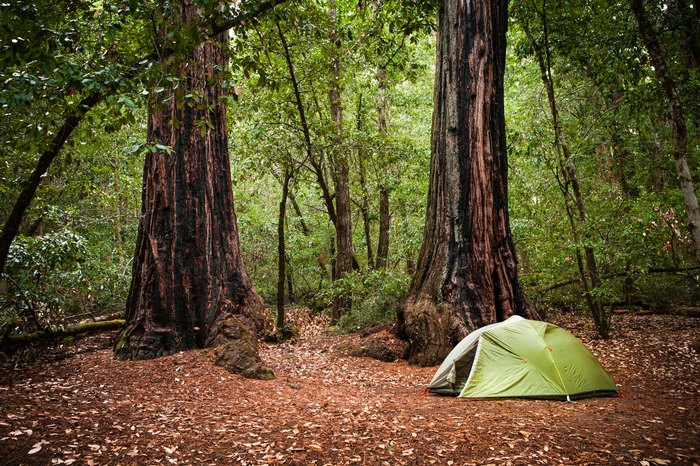
Best campgrounds The Most Epic Resort Campground In Northern California Is An Outdoor Playground The Entire Family Will Love By Kate Freeman
Pastries Taste The Best Cinnamon Rolls In Northern California At This Family-Owned Bakery Cafe By Kate Freeman
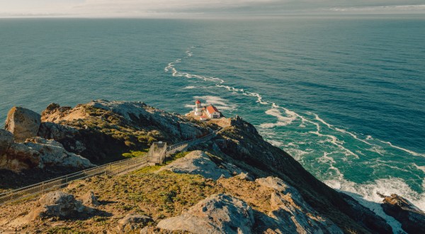
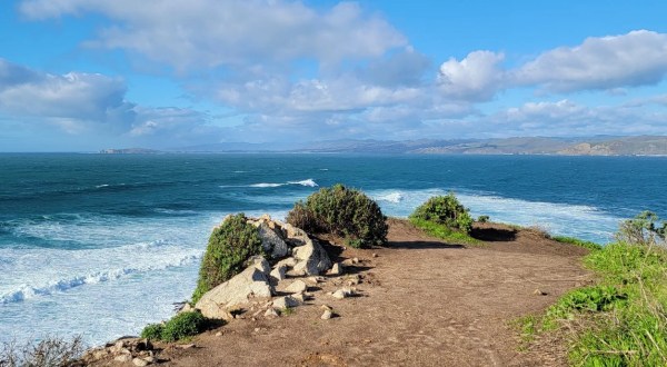
Tomales Bay The Iconic Hiking Trail In Northern California Is One Of The Coolest Outdoor Adventures You’ll Ever Take By Kate Freeman
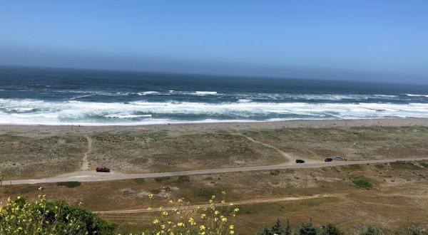
Beach park The Ocean Views From This Bay-Front Northern California Park Are Jaw-Droppingly Gorgeous By Kate Freeman
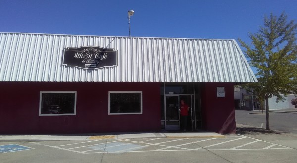
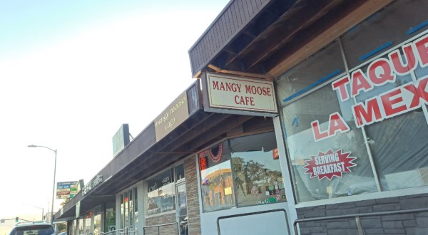
Huge portions The Portions Are Huge At This Northern California Breakfast Spot Loved By Locals By Kate Freeman
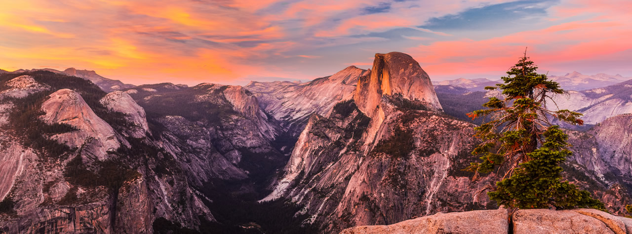
Hidden California 15 Stunning Photos Of Northern California You Won’t Believe Aren’t Photoshopped By Kate Freeman
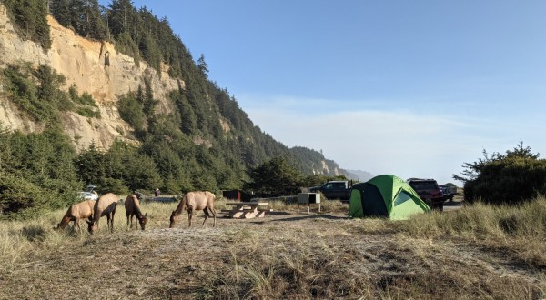
Beach This Year-Round Campground In Northern California Is One Of America’s Most Incredible Oceanfront Oases By Kate Freeman
Camping You’ll Never Forget Your Stay At Anchor Bay, An Oceanfront Campground In Northern California By Kate Freeman
Mendocino Celebrate Crab Season With Northern California’s Mouthwatering Seafood And Sips Festival By Kate Freeman
Lake tahoe Enjoy Delicious Mexican Food And Margaritas Inside A Cabin At This Northern California Restaurant By Kate Freeman