
18 Best Hikes In Maine: The Top-Rated Hiking Trails To Visit In 2024

Michelle
Author
Before roads and buildings, boardwalks, and shopping malls, the country was untamed and natural. With that in mind, a hike might just be the best way to get to know any part of the country. Maine offers some of the best natural landscapes, both inland and along the coast, and the trails on this list represent some of the best hikes in Maine. Be sure to save this list for the next time you’re in the mood to explore!
Best Hikes in Maine
There’s nothing quite like exploring the great outdoors in Maine. While there are certainly enough trails to categorize them into preferences, there are some that are so special they rise to the top of any list. From the views towering over Acadia National Park to the ones that have us enjoying a quiet lake, these are some of the best.
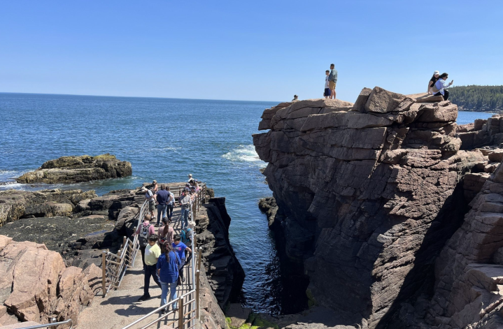
1. The Beehive Loop Trail

- Location: Bar Harbor, Acadia National Park
- Mileage: 1.5-mile loop trail
- Difficulty: Hard
- FYI: Acadia National Park charges a fee per vehicle or motorcycle. If you’re entering on foot, the fee is per person. While the trail can be done in either direction, counterclockwise makes the route slightly less demanding. Park at the Sand Beach parking area, which is serviced by the shuttle in season. There are restrooms here, too. Hikers should be experienced and dogs, while permitted, are really best left at home.
Considered a must-do in Acadia National Park, The Beehive Trail is one of the most well-known hikes in the state. The Beehive Loop trailhead can be found at the Sand Beach Parking Lot, which hikers can either drive to or find via the park’s shuttle. The loop begins here and then heads over the Beehive before reaching the Bowl Pond. From here, the loop heads back on the Bowl Trail. The gorgeous views on this trail are unmatched and worth every ladder and rung required to complete it. There are a few scrambles depending on the direction you choose, but AllTrails recommends going counterclockwise, which is a bit easier.
2. Jordan Pond Path

- Location: Bar Harbor, Acadia National Park
- Mileage: 3.1-mile loop trail
- Difficulty: Easy
- FYI: Acadia National Park charges a fee per vehicle or motorcycle. If you’re entering on foot, the fee is per person. The route is considered easy, but there is one area of rocky terrain. This trail can get busy, so it’s best to visit early to ensure space and parking. Feel free to bring your furry friends, but all dogs must be on a leash of at least 6 feet. Always check them for ticks after your hike. Also, swimming and wading are not allowed in the pond.
It’s almost hard to believe that one of the most incredible views in all of Acadia National Park includes just about no elevation gain, and comes via what’s considered an easy hike. The loop makes its way around Jordan Pond, offering views of both the water and the North and South Bubbles. Jordan Pond Path features a mix of rocky paths, smooth trails, and boardwalks, making it engaging and fun and family-friendly. If you plan your visit for the afternoon, the light shines off the water making it extra special.
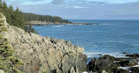
3. Gorham Mountain Loop

- Location: Bar Harbor, Acadia National Park
- Mileage: 3-mile loop trail
- Difficulty: Moderate
- FYI: Acadia National Park charges a fee per vehicle or motorcycle. If you’re entering on foot, the fee is per person. This is a gorgeous trail to do year-round, including during the winter. Be sure to wear proper footwear for slippery conditions, as the trail can change at any time. Feel free to bring your furry friends, but all dogs must be on a leash of at least 6 feet. Always check them for ticks after your hike.
Considered one of the best day hikes in the state, this popular trail offers some of the best Maine hiking you can find. The mountain trail traverses ledges, following the shores of the Atlantic, all while offering absolutely gorgeous views. In addition to the scenic nature of the trail itself, the route passes the iconic Thunder Hole which creates a thunderous noise every time a wave slams into a small cave below. One of the most beloved hikes in the park, this is a great hike for those who want to see some of the quintessential Maine landscape in the region.
Best Short & Easy Hikes in Maine
While “easy” is certainly subjective depending on experience level and mobility, these hikes offer a good entry into the world of hiking. Not too long, with minimal elevation gain, these easy hiking Maine adventures are great for those who aren’t looking to work up a sweat. Each trail on this list is also fantastic for helping small children fall in love with the outdoors.
4. Thunder Hole to Sand Beach
- Location: Bar Harbor, Acadia National Park
- Mileage: 1.7-mile out-and-back trail
- Difficulty: Easy
- FYI: Acadia National Park charges a fee per vehicle or motorcycle. If you’re entering on foot, the fee is per person. This is a gorgeous trail to do year-round, including during the winter. Be sure to wear proper footwear for any changes in conditions. Remember that the trail is maintained, but can become more dangerous if the weather is inclement. Feel free to bring your furry friends during most of the year, but all dogs must be on a leash of at least 6 feet. The only time dogs are not permitted is between June 15 and September 8 each year.
This trail offers access to one of Acadia National Park’s most notable natural features. Thunder Hole is a cave located at the same level as the waves crashing to the quintessential New England shore. When air escapes from the cave each time a wave hits, visitors can hear a booming sound. Start your journey at the Thunder Hole Information Center which is across the street from Thunder Hole. Spend some time here before heading along Ocean Path toward Sand Beach. Thunder Hole Trail follows the Park Loop Road and doesn’t have much shade, so be sure to come with something to protect yourself from the rays. While the starting point and destination on this 1.7- mile hike are the features here, the route also has plenty of wonderful vistas along the way. Plan on the entire round trip journey taking about 45 minutes to one hour.
5. Cadillac Summit Loop Trail

- Location: Bar Harbor, Acadia National Park
- Mileage: .5-mile loop trail
- Difficulty: Easy
- FYI: Acadia National Park charges a fee per vehicle or motorcycle. If you’re entering on foot, the fee is per person. Cadillac Summit Road requires reservations beginning in late May and running through late October. This is a gorgeous and simple trail to do year-round, including during the winter. While relatively flat and simple to follow, remember that conditions can change at any time. It’s best to have strong footwear and layers. Dogs make a great addition to this hike, but be sure to have them on a six-foot leash.
While some Maine hikes lead to the summit, the Cadillac Summit Loop Trail actually begins at the top of Cadillac Mountain! That means the stunning views begin before you’ve even taken a single step on the half-mile route. Relatively flat with minimal increase in elevation, this is a good trail for those who want an outdoor adventure that’s simple and short. The entire walk should take about 15 minutes, but we recommend you enjoy the views from the benches which means spending a bit more time. Because Cadillac Summit Loop is really just a walk, it’s likely to be crowded. Try to get there early to avoid crowds. While simple, this is one of the most beautiful hikes in New England.
6. Great Head Trail (Full Loop)

- Location: Seal Harbor, Acadia National Park
- Mileage: 1.8-mile loop trail
- Difficulty: Moderate
- FYI: Acadia National Park charges a fee per vehicle or motorcycle. If you’re entering on foot, the fee is per person. This trail can be accessed throughout the year, but it’s considered best from April through October. Dogs are welcome, but be sure they’re on a six-foot leash. Note that this trail has some rocks that might be hard for dogs to navigate.
If you’re looking for an adventure that’s simple, yet offers a challenge, then this is the one for you. While not complicated, there are a few areas with boulders that make this a bit more than just a walk in the woods. As one of the most quintessential Maine trails, you’ll get fantastic ocean views, salty air, and even access to a sandy beach. You’ll find the trail on the east side of Sand Beach. Follow it around the perimeter of the small peninsula known as Great Head. As you make your way keep an eye out for the pink granite rocky cliffs that this hike for which this hike is known.
Hardest Hikes in Maine
I love a challenge and the hikes here are some of the most heart-pounding and mentally stimulating. Whether it’s scrambling over rock, or working to build up your endurance to be on the trail for multiple hours, these hikes will leave you with a sense of true accomplishment.
7. Hunt, Knife Edge, Helon Taylor, Chimney Pond, and Cathedral Trail Loop

- Location: Millinocket, Baxter StatePark
- Mileage: 17-mile loop trail
- Difficulty: Hard
- FYI: The trailhead for this route is located at the Katahdin Stream Campground. The entrance fee to enter Baxter State Park is at least $16 for non-residents. A season pass can be purchased for at least $42 for non-residents. Be sure to check current fees at the official Baxter State Park website before planning your visit. Baxter also requires a parking reservation at major trailheads. You can find the current reservation requirements by visiting the reservation section of the official website. Bring your favorite friends, but leave the furry ones at home. Dogs are not allowed in Baxter State Park. This trail is considered best between March and October.
One of the best things about hiking in Maine is the sheer number of trails located here. With so many options, it’s easy to go from easy to hard as you gain more experience in the outdoors. When you’re ready, this route is one of the most fun and challenging. Located in Baxter State Park, this combination of some of the best-known trails on Mount Katahdin offers a multi-hour adventure that will have your heart pounding. Hikers will begin their route on the Hunt Trail making their way to Knife Edge Trail. Here, the trail leads up Baxter Peak, Mount Katahdin, South Peak, Chimney Peak, and Pamola Peak. After a few other trails, the adventure returns by following Chimney Pond Trail to Basin Ponds, Great Basin, and South Basin on the Cathedral Trail and Saddle Trail. Eventually, visitors will end up back on the Hunt Trail. Keep in mind that Katahdin is the highest peak in Maine, so this is certainly going to be steeper than other trails. It’s also the northern terminus of the Appalachian Trail. It’s not uncommon to run into backpackers who have recently come out of the 100-mile wilderness to end their multi-month trip.
8. Hunt, Helon Taylor, and Chimney Pond Trail Loop

- Location: Millinocket, Baxter StatePark
- Mileage: 18.7-mile loop trail
- Difficulty: Hard
- FYI: The trailhead for this route is located at the Katahdin Stream Campground. The entrance fee to enter Baxter State Park is at least $16 for non-residents. A season pass can be purchased for at least $42 for non-residents. Be sure to check current fees at the official Baxter State Park website before planning your visit. Baxter also requires a parking reservation at major trailheads. You can find the current reservation requirements by visiting the reservation section of the official website. Bring your favorite friends, but leave the furry ones at home. Dogs are not allowed in Baxter State Park.
Those looking for a challenging hike will undoubtedly find it in Baxter State Park. Home to three of Maine’s tallest peaks, the park is a dream come true for those looking to push themselves physically and mentally. This 18-mile route is a combination of three trails and is estimated to take at least 14 hours to complete. It’s great as a backpacking route, but ambitious and experienced hikers can probably complete it as a day hike. Hikers will take the Hunt Trail all the way to the summit of Mount Katahdin. At the top, the route requires hikers to navigate the challenging Knife Edge and then down along the Helon Taylor trail. Ultimately, hikers will head towards the Roaring Brook Campground.
9. Hamlin Ridge and North Peaks Trail

- Location: Stacyville, Baxter StatePark
- Mileage: 17.8-mile out-and-back trail
- Difficulty: Hard
- FYI: Entering Baxter State Park requires a fee of at least $16 for non-residents. A season pass can be purchased for at least $42 for non-residents. Be sure to check current fees at the official Baxter State Park website before planning your visit. Baxter also requires a parking reservation at major trailheads. You can find the current reservation requirements by visiting the reservation section of the official website. This route is considered best between March and October. Bring your favorite friends, but leave the furry ones at home. Dogs are not allowed in Baxter State Park.
It’s hard to believe that so many challenging and adventurous hikes can be found within just three hours of Portland at Baxter State Park. And, it’s not far from New Hampshire. When you’ve been to the White Mountains countless times, it might be time to head north to see what Maine has to offer. This trail, with an elevation gain of more than 6,700 feet, offers everything the most challenging trails offer and more! Hikers will begin along Basin Pond. From here the elevation quickly increases and climbing is required. The trail goes over Hamlin Peak and Howe Peak before heading back down. Things come to a close at the conjunction of the North Peaks Trail and Northwest Basin Trail. From here, simply turn around and head back the same way you came.

Best Waterfront Hikes in Maine
With more coastline than California, Maine has some of the best access to water. When you also add the inland lakes and rivers, it’s no wonder there are so many incredible waterfront hikes to enjoy in Vacationland. These hikes can be enjoyed year-round, making them perfect for those who appreciate Maine’s beauty regardless of the season.
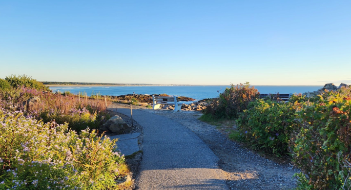
10. Bar Island Trail
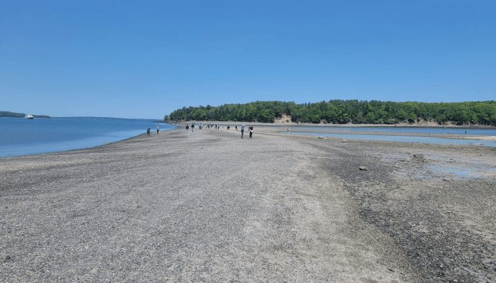
- Location: Bar Harbor, Acadia National Park
- Mileage: 2.1-mile out-and-back trail
- Difficulty: Easy
- FYI: Park in downtown Bar Harbor near Bridge Street to access this unique walking route. This is a beautiful, scenic trail to do year-round, including during the winter. But, be sure to keep track of the tides. This trail is only accessible during low tide, which happens just once every nine hours. If you find yourself stuck, you’ll need to get a water taxi back to shore. Dogs are welcome to come along for this hike, but be sure to follow the Acadia National Park rules and have them on a six-foot leash.
One of the most interesting and unique trails in the state, this route leads to Bar Island via a gravel bar that can only be seen during low tide. That means you’ll need to time things just right in order to access it. While the route is short and should take under an hour, you’ll want to time your visit for about 1.5 hours prior to before or after low tide. After walking across the bar, you’ll arrive at the island where the Bar Island Trail becomes more of a small road. Spend some time enjoying the sites before heading back to town the same way you came.
11. Marginal Way (CLOSED)
- Location: Ogunquit, York County
- Mileage: 2.4-mile out-and-back trail
- Difficulty: Easy
- FYI: Ogunquit is one of the most popular tourist destinations in the state, which means this trail is likely to be busy during any season that’s popular among visitors. The route is open year-round and it’s beautiful during any season. The trail is about five feet and both strollers and wheelchairs can manage the route. A wheelchair can be borrowed from the Ogunquit Fire Department. During the on-season visitors can park in Perkins Cove or Obed’s Lane Lot for a fee. Bikes are not allowed on the path. However, your furry friends are allowed between October 1 and April 1.
Perhaps one of the most gorgeous walks in the state, the Marginal Way in Ogunquit offers ocean views and wonderful salty breezes. The route is about 1.25 miles each way, running along the rocky shore from the Shore Road starting point to Perkins Cove. The path is mainly flat, but there are about 40 benches to use if you’d like to rest. For anyone in search of the perfect quintessential Maine stroll, this is it! Plus, visiting means spending time in town, enjoying the local restaurants, shops, and sights. If you’d like to turn your visit into a long weekend, consider a hotel stay to make it extra special.
12. Mackworth Island Hiking Trail
- Location: Falmouth, Mackworth Island State Park
- Mileage: 1.4-mile loop trail
- Difficulty: Easy
- FYI: Mackworth Island State Park is open year-round, but in the winter icy conditions can make the trail a bit harder to navigate. The fee to enter the park is at least $4 for non-residents, $3 for residents, and $1 for non-resident seniors. Parking can be limited during the busy season, so try to arrive early to ensure you can enjoy the day. Dogs can come along for this adventure, but be sure to keep them on a leash.
This simple loop trail is a great option for those who would rather spend most of their time outside versus in the car driving to their destination. The park, located in Falmouth, is just a few minutes from downtown Portland but it feels like a world away. The loop begins right off the parking lot and circles the entire area. Be sure to take some extra time to enjoy the historical sites, such as the burial ground for Maine Gov. Percival Baxter’s beloved animals. Kids will also enjoy the fairy village where visitors create small homes for these mystical beings. Just about all of this hike includes views over Casco Bay so plan on spending enough time to go slowly, taking in everything wonderful about this region of the state.
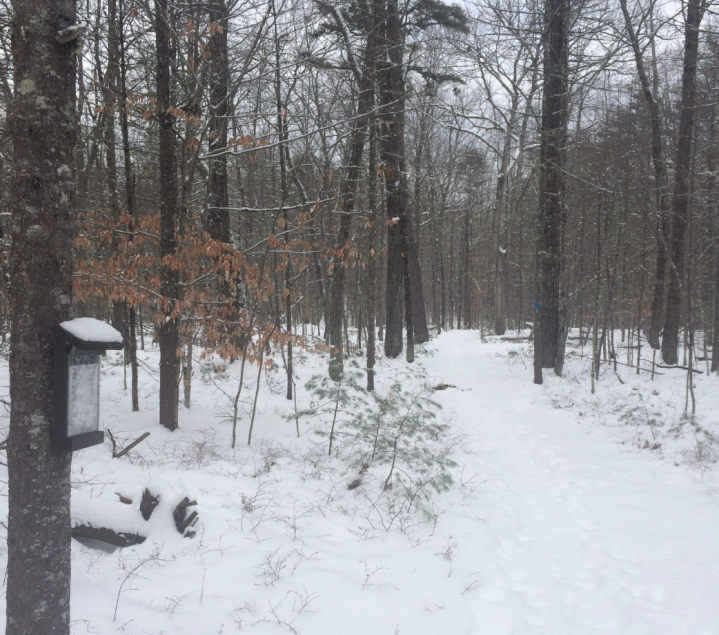
Best Winter Hikes in Maine
It takes a hearty hiker to get outside in the winter and these trails are perfect for those strong individuals. Head out in layers to enjoy some of the best routes that are even more beautiful when the temperatures drop. If you’re lucky, you might even be able to enjoy these with a coating of snow. Of course, be sure to wear layers and be prepared for any sudden weather changes.
13. South Link, North Link, and Outer Loop Trail
- Location: South Casco, Sebago Lake State Park
- Mileage: 1.5-mile loop trail
- Difficulty: Easy
- FYI: Sebago Lake State Park is open year-round, but in the winter icy conditions can make the trail a bit harder to navigate. The fee to enter the park is at least $8 for non-residents, $6 for residents, and $2 for non-resident seniors. Dogs can come along for this adventure, but be sure to keep them on a leash.
The beautiful location of this hike helps make it one of the most lovely in the state. The loop is created by the combination of the North Link and South Link trails and the resulting two miles along Sebago Lake is simply wonderful. Any elevation gain is virtually non-existent so this is a great activity for anyone who might be new to hiking. It’s also a fun way to get kids excited about the outdoors.
14. Knight's Pond Red Trail

- Location: Near North Yarmouth
- Mileage: 1.8-mile out-and-back trail
- Difficulty: Easy
- FYI: There is no fee to enter the preserve in which this trail exists. The hike can be done any time of year, though the winter can bring some icy conditions. Plan on about 45 minutes to an hour for the adventure and, feel free to bring dogs on a leash.
The simplicity of this trail is part of what makes it so appealing. The main attraction here is the small, but mighty Knight’s Pond. While not the largest body of water in the state by any stretch, it’s a fantastic representation of how many hidden gems can be found here. The Red Trail leads straight to the pond by going over both Blueberry and Bruce Hills. We love hiking here, but remember to bring snowshoes in the winter. As with so many Maine trails, it feels like a completely different place during every different season.
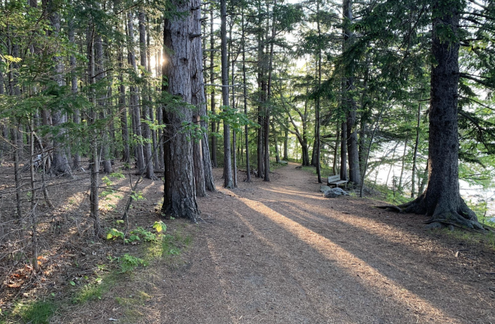
15. Bowl Loop

- Location: Jefferson, Hidden Valley Nature Center
- Mileage: 2.7-mile loop trail
- Difficulty: Easy
- FYI: Hidden Valley Nature Center offers 1,000 acres of fun to explore for a fee of $5 due for all non-members. The HVNC offers miles of trails for a variety of activities. They also offer classes for visitors to learn new skills, as well as camping sites. The center is open from dawn to dusk, except for those staying overnight. Fogs on leashes are welcome.
From Camden Hills State Park to Grafton Notch State Park, we love the park system here in Maine. But there are plenty of other ways to enjoy the great outdoors. The Hidden Valley Nature Center offers a one-stop shop for tons of outdoors adventures. There are more than 1,000 acres of forest here filled with multi-use trails that can be enjoyed year round. They even offer skills courses to help visitors add to their adventures. The Bowl Loop is relatively flat and under three miles, making it perfect for new hikers of all ages. You’ll find it in the northern section of HVNC, which is sometimes considered to be steeper than the rest of the area. Once you’ve enjoyed the Bowl Trail, explore any of the other routes that come off of it.
Best Hikes near Augusta
Maine’s capital city is full of history and culture. But, it’s easy to overlook the fact that there are plenty of outdoor opportunities nearby. Plant yourself here for a long weekend and enjoy the myriad parks and trails that offer tons of beauty and adventure.
16. Kennebec River Rail Trail
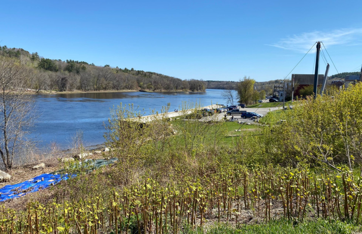
- Location: Augusta
- Mileage: 12.9-mile out-and-back trail
- Difficulty: Easy
- FYI: There’s a parking lot with portable toilets located at the start of this walk. There is no charge for enjoying this trail and dogs on a leash are welcome to come adventure with all visitors. There are at least five accessible spaces in the parking area found off of Water St., which is at the north end of the trail.
If you’re looking for a great way to enjoy the outdoors without having to travel into the more remote parts of the state, the Kennebec River Rail Trail is a great trail to explore. At nearly 13 miles, we recommend walking along a different portion every time you visit. Or, if you’re feeling adventurous, tackle the entire thing in a day. It should take about 4 hours, depending on how fast you walk and if you like to stop and rest. The city views are beautiful and being able to see the river while you walk makes it even more special. It might not be the water views of Moosehead Lake, but you’ll love this special part of Maine.
17. Viles Arboretum

- Location: August
- Mileage: 1-mile loop trail
- Difficulty: Easy
- FYI: The arboretum is open year-round from dawn until dusk and is beautiful to visit in any season. There’s no charge for entry, but feel free to donate on their website.
There are plenty of special spots to enjoy throughout the state, but little Viles Arboretum is one of the best. With more than six miles of trails offering access to lots of nature, this is a great day trip for those who enjoy the outdoors. The trails here can be enjoyed any time of year, but no matter when you visit you’ll forget you’re near a city.
18. Bond Brook Trails

- Location: Augusta, Bond Brook Recreation Area
- Mileage: 3-mile loop trail
- Difficulty: Moderate
- FYI: There are no fees to enter this recreation area. Hiking trails range from easy to moderate to advanced, making this a great option for visitors of all experience levels. Pets are permitted, but it’s always best to keep them on a leash when others are around.
This beautiful recreation area offers 270 acres of forested land to explore. There are ton of trails, but the three-mile loop offers a nice, middle-of-the-road option to try. Some slight elevation gain makes it more moderately challenging, but kids who have some hiking experience will likely be able to handle this. Some of the trails in the area are reserved for cross-country skiing in the winter and hikers are not permitted.
Whether you’re visiting Maine for the first time or have lived here all your life, there’s always something new to explore. And, understanding the diverse landscape here can make a huge difference in feeling a connection to Vacationland. Have you explored any of these featured best hikes in Maine? If you have, we’d love to hear any tips and tricks you have for making a visit the best it can be. And, if you’d like some help getting outside more often and more meaningfully be sure to try AllTrails+ for free!
After exploring some of the best places to hike in Maine, be sure to check out some of the other activities that make visiting so special. Another great way to see the sights is by taking a local road trip and we’ve got some of the best!
OnlyInYourState may earn compensation through affiliate links in this article. As an Amazon Associate, we earn from qualifying purchases.
More to Explore
Best Hikes In Maine
Does Maine have good hiking trails?
Maine has a wide variety of good hiking trails. And, it's easy to find options catering to every ability level and age. Here are a few popular trails to try:
- The Abandoned Train Hike, Maine North Woods: This hike is best for those who are hearty hikers looking for a true adventure. Located in Maine's remote North Woods, the route leads to two abandoned locomotives from the Cold War era!
- Fort Williams Park Trail, Cape Elizabeth: This simple route is really more of a stroll, leading from the parking lots to the ruins of an abandoned home. The real benefit of this hike is the beauty of the water and the lighthouse.
- The Ship Harbor Nature Trail, Acadia National Park: This beautiful trail leads through the woods and along the coast. It's also said to be haunted!
What are the best months to hike in Maine?
The best months to hike in Maine are May through October. As a general rule, you'll want to stick to months that offer safe conditions. However, depending on your ability level and interests, hiking can be done year-round in Maine.