You'll Probably Have This Secluded Waterfall And Swimming Hole To Yourself In Arkansas
By Carol Ann Carson|Published August 21, 2019
×
Carol Ann Carson
Author
Arkansas native, Carol Ann Carson, has written for OnlyInYourState for three years now. She resides in Western Arkansas' Mountain Frontier but calls NWA home as well. The graduate of University of Arkansas - Fort Smith, Carol Ann earned her B.A. in English and will soon be pursing her M.A. in Library Science. She loves exploring the trails around the Buffalo National River and has yet to find a waterfall that wasn't her favorite.
Cedar Falls and Devil’s Den are certainly lovely but sometimes you want a beautiful sight without the masses of sightseers. The hike to White Rock Creek may not be the easiest but it definitely has a fantastic payoff. Let’s take this trail for a quiet reconnect with nature.
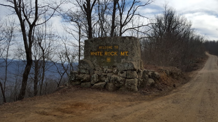
The White Rock Creek Falls Trail begins, naturally, at White Rock Mountain.
This trail is also known as White Rock Creek Cascades Trail as well as the White Rock-Shores Lake Trail West Trail. Official name aside, this hike is quite gorgeous and is one of the less populated trails in the Ozarks. The journey begins east of Mountainburg at the White Rock Mountain Recreation Area.
Address: 214 Bowles Gap Road, Winslow, AR 72959
White Rock is stunning on its own so be sure to take in the sights before heading into the forest.
The rec area has plenty of other activities and lodging options including some fantastic cabins. Today's trek isn't the easiest so if you'd like to take a milder trail instead visit this site.
Advertisement
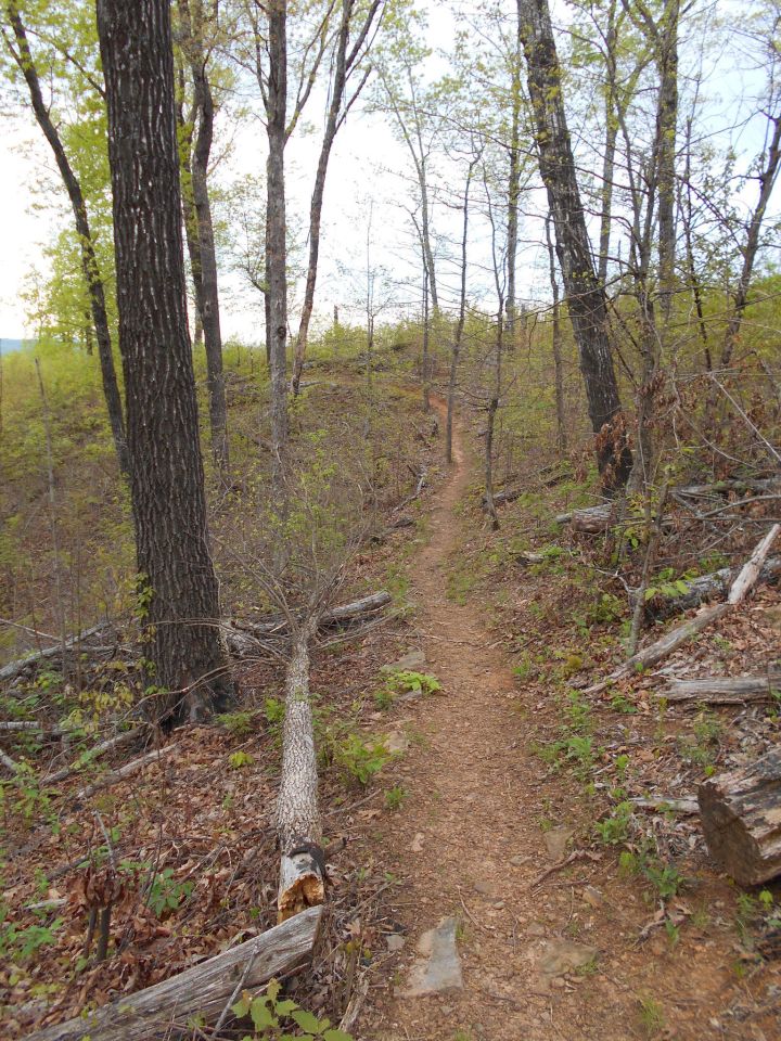
The trail is a side excursion from the Ozark Highlands Trail but it's well worth the detour.
This out-and-back hike takes you from White Rock Mountain Rec Area to the Shores Lake Rec Area, which is about six miles. Take this trail as a steady-paced day's hike or break it up for a backpacking adventure.
Depending on the recent rains, this trail can tour you past multiple falls. The different cascades formed from White Rock Creek and Hurricane Creek are quite peaceful.
The whole trail is a lovely reconnect with nature but the cascades are the biggest highlight.
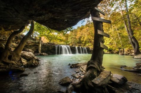
About halfway into the hike you'll come to Bliss Spring Hollow and the always stunning White Rock Creek Cascade. The 10-ft. waterfall has a similar vibe to the more well-known Falling Water Falls or Kings River Falls but with more seclusion.
Depending on the season, you can take quite a refreshing break.
The trail is much easier during a leaf-off season but White Rock Creek does make for a refreshing swim when it's warmer. Regardless if you do swim, the creek and waterfall offer a lovely place to recharge before continuing the trek. Kayakers have ventured along this creek as well.
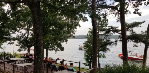
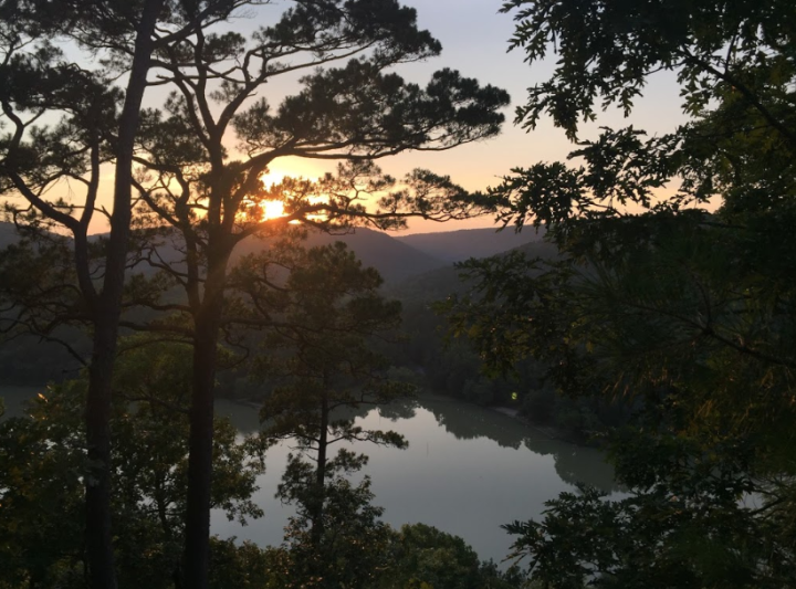
The trail ends at Shores Lake Recreation Area. The lake provides a whole new set of adventures including camping, fishing, and swimming.
From here you can either end your adventure, camp for the night and head back the same way (to complete the 6-mile trail), or continue the loop on the east side. We recommend staying on the west side of the loop if you do need to return to White Rock.
Address: County Road 75, Mulberry, AR 72947
As always, we highly recommend researching more before setting off on your journey. Rick’s Hiking Blog and Ouachita Maps have fantastic details about this trek. Tim Ernst’s waterfall and trail books are excellent resources as well!
Have you traversed this trail before? We would love to see your photos in our Facebook group, Arkansas Nature Lovers. You should join for your chance to be featured and to discover why there’s nothing better than Arkansas’ stunning nature.
OnlyInYourState may earn compensation through affiliate links in this article. As an Amazon Associate, we earn from qualifying purchases.